Sample Chapter
Brown County State Park
Chapter title – Brown County Geology
Southern Indiana
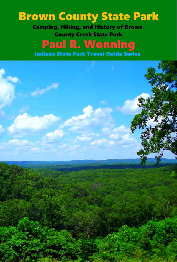
The southern one third of the state has never, as far as geologists can tell, been covered by glaciers. This region has some of Indiana’s most ancient soils and terrain. Most of the state’s bedrock layer consists of limestone, dolostone, sandstone, and shale. Much of southern Indiana is underlaid with limestone. Much of the southern area consists of Karst landscape. In this type of landscape acidic groundwater flows through the limestone bedrock, dissolving it. This action over time creates sinkholes in the surface, underground caverns and disappearing streams. One predominant feature of south central Indiana is the Knobstone Escarpment. Brown County State Park is located in the an area that bears the name Knobstone Escarpment, which in turn is one of four parts of a region termed the Norman Upland.
Knobstone Escarpment
The Knobstone Escarpment includes some of Indiana’s most rugged terrain. It stretches from Brown County State Park in the north to the Ohio River. The region’s main geologic features include steep hills, deep ravines and rock composed mostly of silica rich siltstone. Elevations range from 360 feet near the mouth of the Wabash River to Weed Patch Hill, which has an elevation of 1,056 feet above sea level. This hill is in Brown County State Park and is the third highest area in Indiana. The Brown County Fire Tower is located on this hill.
Top of Page
Mossy Feet Books on Social Media
Twitter
Linkedin
YouTube
Pinterest
Online Sources for Mossy Feet Books
Paul Wonning’s Books on Amazon Page
Paul Wonning’s Books on Scribd Page
Paul Wonning’s Books on Apple
Paul Wonning’s Books on Kobo
Paul Wonning’s Books on Barnes and Noble
Paul Wonning’s Books on 24 Symbols
Paul Wonning’s Books on Google Play
Paul Wonning’s Books on Indigo
Paul Wonning’s Books on Playster
Paul Wonning’s Books on OverDrive
Search Paul Wonning on Ingrams
Table of Contents
© 2021 Paul Wonning
