Sample Chapter
McCormick’s Creek State Park
Chapter title – General Geography
Two historic events that occurred eons ago created the landscape contained in McCormick’s Creek State Park. The first was a shallow sea that covered the region that is now Indiana about 250 million years ago. Dead sea creatures, corals and sand settled at the bottom of this sea. The rock present in the canyon of McCormick’s Creek is in three layers, the oldest at the bottom is called Salem Limestone. Hikers can find this layer in the Limestone Quarry near the canyon’s mouth on the Quarry Loop that branches off from Trail 2 and 7. The next layer is the sixty foot thick St. Louis Limestone, which makes up the majority of the canyon walls. Near the top of the falls this layer ends, topped by the Ste. Genevieve Limestone.
Uplifting
The earth’s surface is not static and various forces like continental drift and uplifting are constantly occurring. Uplifting of the earth’s surface drained the shallow sea, exposing the seabed to atmospheric forces.
The Illinoisan Glacier Forms
During the Pleistocene Era a vast glacial sheet covered most of North America.
Pleistocene Era
The Pleistocene Age began roughly two million years ago and ended about 10,000 years ago. During this vast period of time four episodes of extensive glaciations covered most of what is now Indiana. These glaciers created two vastly different landscapes. Roughly the northern two thirds comprise what geologists call the Tipton Till. Glaciers covered this area during all four glacial events. The southern third was probably never touched by the ice. It is a hilly, heavily forested land that still bears the marks of the vast water runoff that occurred when the Ice Age ended around 10,000 to 12,000 years ago.
The Glaciers Form
The Huron-Erie Lobe is the glacier that covered Indiana during the last glacial event. Scientists estimate that the average temperature of the earth was about six to twelve degrees Celsius colder than it is now. Sometime about two million years ago, Earth’s climate cooled. Over vast regions of what is now Canada and North America the temperature dropped below freezing and remained there thorough the year. Snow fell and did not melt. More layers of snow covered this un-melted snow, building up layer after layer of snow. This weight of the accumulated snow turned the snow to ice. The ice formed layers up to two miles thick in the Great Lakes region. Over central Indiana the glaciers were probably a mile thick. This gradually diminished as the ice reached its margins.
Flowing Ice
The pressure deep in the ice field caused the ice to become almost fluid in its movements. The ice flowed over the landscape, carving out rivers and lakes. It also created hills and the dune area around Lake Michigan. The weight of the ice sheet created the Great Lakes basin, and then filled that basin with melt water when the temperatures warmed and the ice melted. Geologist estimate that the ice moved about a foot a day, first advancing, and then retreating. Always it compressed and crushed the terrain beneath it and.
Southern Indiana
Most of the southern portion of the state had glaciers at different times; however there is a segment in the south central region that has never, as far as scientists can tell, had glaciers. During the last episode the boundary was a ragged line from approximately Terre Haute in the West to Brookville in the west. Below that the older Karst topography of caves, sinkholes, knobs and disappearing steams that are not found in the northern areas.
Formation of the Canyon
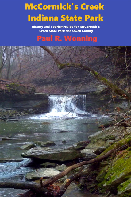
The ice did not reach the site of McCormick’s Creek State Park. When the ice began melting about 50,000 years ago the melt waters began eroding the earth’s surface carving the canyon that now forms the majority of McCormick’s Creek. The climate during that time was wetter and colder, thus the erosion took place at a faster rate than occurs today. The Falls is still eroding the creek bed, but at a much slower rate than during historic times. The running water eroded some of the areas of the softer limestone formations faster than some of the harder formations. This type of geological formation is called Karst Geography. Visitors will find numbers sinkholes, caves and natural bridges formed over the ages. The canyon at McCormick’s Creek is about one mile long and almost 100 feet deep.
Karst Geography
Karst terrain forms when water with a slight acid content dissolves underground layers of carbonite based limestone, dolomite, or gypsum which are slightly basic. The flowing water creates caves, springs, disappearing rivers or streams and sinkholes. Most Karst landscape occurs in southern Indiana, though other areas of the state also have it.
Top of Page
Mossy Feet Books on Social Media
Twitter
Linkedin
YouTube
Pinterest
Online Sources for Mossy Feet Books
Paul Wonning’s Books on Amazon Page
Paul Wonning’s Books on Scribd Page
Paul Wonning’s Books on Apple
Paul Wonning’s Books on Kobo
Paul Wonning’s Books on Barnes and Noble
Paul Wonning’s Books on 24 Symbols
Paul Wonning’s Books on Google Play
Paul Wonning’s Books on Indigo
Paul Wonning’s Books on Playster
Paul Wonning’s Books on OverDrive
Search Paul Wonning on Ingrams
Table of Contents
© 2021 Paul Wonning
