In the Book:
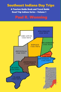
Southeast Indiana Day Trips
Podcast – Southeast Indiana Parks
Related Book
| Clifty Falls State Park | Short History of Public Parks – Indiana Edition | The Ultimate Indiana Day Trip Travel Guide | |
| Contact Author | Other Books in Series | Subscribe to the Page |
Description
In this episode the author visits several of the parks in Southeastern Indiana. The selection includes state parks, state forests, nature preserves, local parks and National Wildlife Refuges. The parks discussed include:
Deam Lake
Clark State Forest
Brookville Lake
Whitewater Memorial State Park
Clifty Falls State Park
Lamplighter Riverfront Park
Big Oaks National Wildlife Refuge
Muscatatuck Park
Calli Nature Preserve
Versailles State Park
Hardy Lake and Campgrounds
From the book:
Southeast Indiana Day Trips,
Deam Lake
Greetings, today I want to talk about southeastern Indiana parks. My book, Southeast Indiana Day Trips from my Road Trip Indiana Series will provide you with all of the information you need to explore the parks in the nine counties in the southeast part of the state. The book includes much more information than I can put in these podcasts. This is the first book in the series and the only one available now. I will have the rest, there will be 9 altogether, as the year progresses. With rising gas prices many Hoosiers, including my wife and myself, are choosing to vacation closer to home. Using this podcast, I will tell you about the many places here in Indiana you can visit and have some unique and fun experiences.
I will now tell you about each of the wonderful museums in southeastern Indiana.
I will begin in Clark County and Deam Lake.
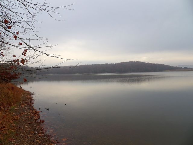
Deam Lake is a 194-acre lake that has a swimming beach with shower and bathhouse facilities, a handicap ramp and a food concession stand. There is lake access for boating via a boat ramp. Motor boats are limited to the use of an electric trolling motor. Rowboat rentals are available during the summer season.
The Indiana Department of Natural Resources has classified Deam Lake as a multi-use property. This means that a multitude of outdoor activities can be going on at the same time. These activities include swimming, hiking, hunting, horseback riding, boating, picnicking, fishing and camping. There are designated hunting areas in the facility, away from the other recreational activities.
There are a number of different kinds of forest trails at Deam Lake. The four hiking trails cover a variety of terrain and total almost seven miles. There are almost eighty miles of horse trails and five miles of mountain bike trails.
Camping facilities include a horseman’s camp and 116 Class A campsites. Class “A” facilities include electrical hookup, modern restrooms with showers picnic table, fire ring and parking spur. Drinking water and a dump station are also available in the area.
There are several picnic areas located around the facility, many with shelters. This southern Indiana park is a great place to visit.
Deam Lake State Recreation Area
1217 Deam Lake Road
Borden, IN 47106
(812) 246-5421
Clark State Forest
And now a bit about Clark State Forest
At the time of settlement, vast forests covered Indiana. These forests spawned many industries dependent on the high quality hardwoods found in these forests. Many furniture makers located in the state and the ship builders along the Ohio River needed the lumber for shipbuilding. In addition, much of the valuable timber was exported.
By 1900, many areas had become deforested. concern rose that the valuable industries that created jobs would close due to lack of wood. To deal with the problem, the Indiana General Assembly created the Indiana State Board of Forestry in 1901. In 1903, the State purchased land in Clark County and established Clark State Forest to experiment with forest management practices and grow tree seedlings. The State appointed Charles Deam to oversee the operation of the Forest. The initial purchase of 2023 acres has grown to over 20,000 acres today. Many other State Forests have joined the ranks since them, preserving Indiana’s forest heritage.
Charles Deam (August 30, 1865 – May 29, 1953)
Charles Deam entered life on a farm near Bluffton in Wells County, Indiana. His father taught him about plants as he grew up, spurring his lifelong interest in botany. He attended DePauw University, but had to leave after his second year because he could not afford the tuition. He got a job as clerk in a pharmacy where the long hours led to exhaustion and high stress. His doctor recommended long walks in the forest to relieve the stress. On these walks, Deam studied the plants and collected specimens. His interest and collection grew and his collection soared to over 78,000 plants. Indiana University acquired his plant collection and Deam joined the Academy of Sciences in Indiana. The Indiana Governor became aware of Deam’s work and appointed him as Indiana’s first State Forester in 1909. He moved to Clark State Forest to create an experimental forest laboratory. It was at his insistence that the State add an additional 2000 acres to the park. His work had lasting consequences on forestry in Indiana and visitors can still see many of his experimental plantings. The Charles C. Deam Wilderness and Deam Lake State Recreation Area are named in his honor.
The Civilian Conservation Corps used Clark State Forest as a training facility during the Great Depression. The CCC built many of the structures in the park as training exercises for the men to learn practices to use in other public lands.
Clark State Forest is very hilly, and the narrow, one lane asphalt system of roads, which wind their way through the Forest, makes a very scenic drive, especially in the autumn when the leaves are turning. There are eight sheltered picnic areas, the nicest ones overlooking Franke Lake. There is Old Franke, probably the best one, and New Franke, on the southwest side of the lake.
Clark State Forest, like all Indiana State Forests, is a mixed-use facility. Hunting and fishing is permitted on the property. There is a popular gun range near Bowen Lake on the west end of the Forest. The State Of Indiana also sells timber from the Forest. Sales from the State Forest provide funds that help administer the State Forest system.
Clark State Forest is located on US 31 about one mile north of Henryville, Indiana and about ten miles south of Scottsburg, Indiana. This is Indiana’s oldest State Forest, established in 1903. It is also one of the prettiest of the State Forests.
There are about one hundred miles of horse trails at Clark State Forest, as well as six parking lots for day users. Horse riding among the wooded hills of Clark State Forest is a popular activity and the weekends will find many horse riders on the trails. Camping and Fishing
The Forest boasts a forty-five site primitive campground. There are seven public lakes ranging in size from thirteen acres to two acres. Franke Lake, at thirteen acres, is on the southeast side of Clark, the main road winding past it and its two picnic areas. Fishing is permitted, with an Indiana Fishing License in any of these lakes.
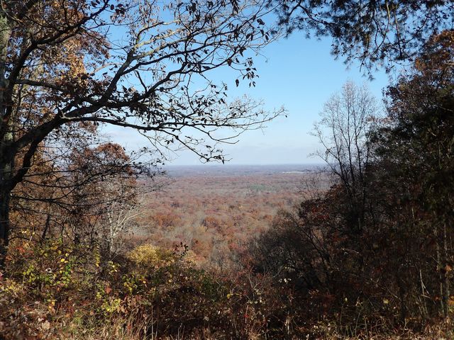
You can complete the loop around the Forest by turning right at the satellite dish antennae, right again on Bloomington Trail. This road then climbs a rather impressive hill up to the fire tower. On the left, just before the fire tower is a picnic area with a very impressive view. On a clear day, the skyline of Louisville, Kentucky, twenty miles to the south can be visible against a background of trees and sky.This leads back to US 31. Maps are available at the State Forest Office, which is just off US 31, the entrance about a quarter mile north of the entrance to Clark State Forest.
The fire tower is the next item of interest on this road. Ninety eight steps to the top, the tower is about one hundred feet tall. At the author’s last visit in 2022 the fire tower was closed.
Clark State Forest
P.O. Box 119
Henryville, IN 47126
(812) 294-4306
Brookville Lake
Now we go to Franklin County and Brookville Lake.
Brookville Lake encompasses 5,260 acres and has plenty of outdoor recreational opportunities for the water enthusiast. There are several marinas for the boat access, two swimming beaches, plenty of playgrounds and picnic area and several miles of hiking trails. Hunting and fishing opportunities are available in designated areas.
Mounds State Recreation Area
Quakertown State Recreation Area
Brookville Lake Beach
Brookville Lake Beach is a great place to visit on a hot Indiana day. The scenic area is a perfect place to relax, swim and picnic. There are two beaches at Brookville Lake. One is at the Quakertown Recreation Area on the northwest end of Brookville Lake, and the other is at Mounds State Recreation Area on the east central portion of the lake.
The State of Indiana operates two State Recreation Areas at the lake, Mounds and Quakertown. Brookville Lake encompasses 5,260 acres and has plenty of outdoor recreational opportunities for the water enthusiast. There are several marinas for the boat access, two swimming beaches, plenty of playgrounds and picnic area and several miles of hiking trails. Hunting, camping and fishing opportunities are available in designated areas.
Brookville Lake
State Road 101
Brookville, IN
Mailing Address:
P.O. Box 100
Brookville, IN 47012
(765) 647-2657
(765) 647-2658
Mapping Address for Quakertown:
3056 Quakertown Ramp Rd.
Liberty, IN 47353
Mapping Address for Mounds SRA:
14108 SR 101
Brookville, IN 47012
https://www.in.gov/dnr/state-parks/parks-lakes/brookville-lake/
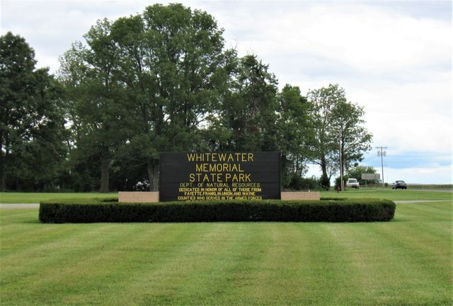
Whitewater Memorial State Park
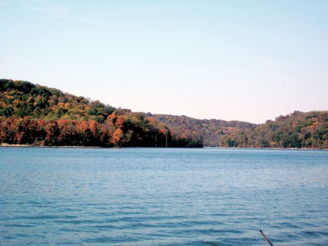
The 1710 acre Whitewater Memorial State Park offers visitors seasonal access to Brookville Lake, camping, picnicking, lake activities at 180 acre Whitewater Lake and hiking. Established in 1949 as a memorial to the men and women who served in the military during World War II, residents of Union, Fayette and Wayne Counties worked to acquire the land for the park. Hikers will find almost 5 miles of trails at the park. The campsite has 236 electric sites and 45 primitive sites. Equestrians will find 45 primitive sites and nine miles of bridle trails. Anglers can fish in Whitewater Lake or at nearby Brookville Lake. Whitewater lake has two boat ramps, one for Whitewater Lake and one for Brookville Lake. Picnickers have several picnic areas and shelters. The camp store sells firewood, ice, as well as picnic and camping supplies. During the summer months visitors can rent Canoes, Paddle boats and Rowboat.
Whitewater Memorial State Park
1418 S. State Road 101
Liberty, IN 47353
(765) 458-5565
http://www.in.gov/dnr/parklake/2962.htm
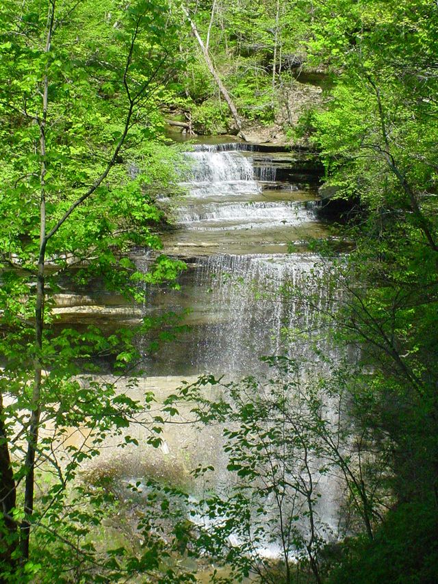
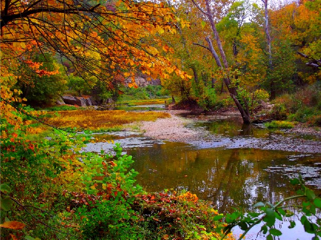
Clifty Falls State Park
In Jefferson County, along the Ohio River, we find .
There are two entrances to the 1414 Acres Clifty Falls State Park. The North Entrance is on State Road 62 a few miles west of its intersection with US 421. When you pull in this entrance, Clifty Shelter is to the right. This is a big shelter with lots of room for picnicking. There is a large field suitable for soccer, badminton, etc. The south entrance is on State Road 56, which also goes east into downtown Madison. Clifty Inn is on the left of this entrance after you ascend the hill.
Clifty Falls State Park Activities include picnicking, picnic shelters, camping, hiking and veiwing waterfalls.
Twelve hiking trails that total 12 miles. Most of these trails are quite rugged. Trail 2, which follows the boulder-strewn Clifty Creek, bed, makes a tough and beautiful hike. The stair on the north end that leads to Clifty Shelter has been out of service for years, so there is no access to the Shelter from this trail. By stringing trails 7, 6, 5, 4, 3, 2, 1 and 8 hikers can circumvent the Canyon. This “Canyon Loop” is approximately seven miles long. It will take about six hours of leisurely hiking. It is necessary to hike a short distance along Clifty Drive to connect with Trail 6 at Hickory Grove with Tunnel Falls. The loop follows the east rim of the Canyon. Then it descends into the valley and crosses Clifty Creek. From the creek, it climbs a long, wildflower lush slope to follow the western rim of the Canyon. The last trail of the loop is Trail 8 that emerges just north of Clifty Shelter.
The nature center, located near Clifty Inn, has information on the park’s interpretive and recreational programs.
Situated on a bluff overlooking the Ohio River, Clifty Inn has sixty-three rooms. Thirty-seven of these have balconies with a view of the Ohio River and downtown Madison Indiana. There is also an indoor pool. There are also four suites and banquet and conference rooms.
Clifty Inn has a restaurant that serves breakfast, lunch and dinner seven days a week.
Clifty Inn Amenities include an indoor swimming pool, a large sun porch to set back and relax while overlooking the Ohio River, and a sitting room.
Clifty Inn
1314 Clifty Hollow Rd.
Madison, IN 47250
Clifty Falls State Park draws its name from Clifty Falls that tumbles sixty feet into the canyon below. Clifty Falls is visible from an overlook near Clifty Shelter. Clifty Shelter is on the north end of the park. There are three other waterfalls in the park, none of which are visible from the main drive. Access Little Clifty falls after taking a short hike of about one quarter mile from Clifty Shelter. There are some impressive steps to climb on the way to this falls. Tunnel Falls, so named for its proximity to an old railroad tunnel, is just a short distance from the main drive around the park. Again, there is a stairway to descend down to the trail. Access the Hoffman Falls by descending another long stair down to the trail.
The campground is near the center of the park. Signs will direct you there. The outdoor pool is near the campground. You may drive to it, or use Trail 9, a one-mile moderate hike from the campground. The campground has 106 Class A sites. It also has 59 Class C sites. Class A campers have access to modern restroom and shower facilities. Class C sites have pit toilets. Many sites will accommodate trailers. There are no modern wastewater hookups, however a Dump station is available.
Clifty Falls State Park has a swimming pool, water slide and wading pool. The pool is open from the Saturday before Memorial Day and no later than Labor Day. It is on the eastern part of the park and has access to Trails 9 and 10.
Observation Tower
A short hike up Trail 1 from the Inn, the Observation Tower provides a stunning view of the Ohio River Valley.
Nearby attractions to Clifty Falls State Park:
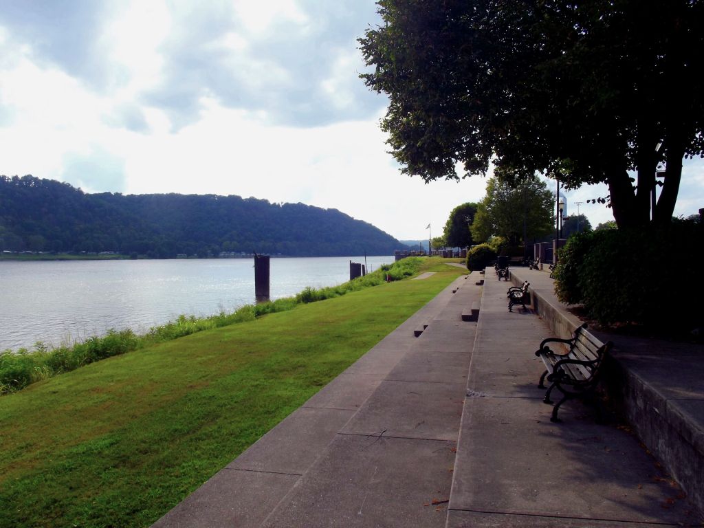
Madison, nestled among the hills on the banks of the Ohio River, is in one of the prettiest settings for a city in our state. With a population of about 12,000, it has a renovated downtown. Visitors will find antique shops, various retail establishments, bed and breakfasts, and restaurants. The riverfront boasts the awesome Riverfront Park. Bricked sidewalks with landscaped areas, this well designed park are the site of the Madison Regatta. This event features the Unlimited Hydroplane Race and boat races in which boats attain speeds of over 200 MPH.
The Ohio River Bridge here crosses into Kentucky via US 421.
State Road 56, east of Madison, wends it way towards Vevay, Rising Sun, and Lawrenceburg. It is about an hour or so drive to the riverboat casinos in Rising Sun and Lawrenceburg. The highway hugs the river for most of the distance and is a pretty drive. Along the way, you will pass Markland Locks and Dam. This facility controls the river level and makes the river consistently navigable for the barges. The locks are on the Kentucky side of the river. To visit them, drive over the bridge that spans the river over the dam.
Lamplighter Riverfront Park
Walk or picnic along the river as you enjoy this wonderful Lamplighter Riverfront Park. Riverboats frequently stop here, and there is dining either on or overlooking the river.Lamplighter Riverfront Park is close to the Madison Main street Business District. Public launch site is available.
Lamplighter Riverfront Park consists of about two acres on the east side of Madison. The trail that passes to the west runs all along the Ohio River riverfront.
Outdoor lamps located in Lamplighter Riverfront Park provide plenty of nighttime illumination and the park has plenty of picnic tables and benches to watch the mighty Ohio River as it passes by. Located on the banks of the Ohio River between Broadway and West Street, Lamplighter Park features a gazebo, benches, and several overlooks which provide a panoramic scenic view.
Lamplighter Riverfront Park
Madison, Indiana
between Broadway and West Street
http://www.madisonparks.com/p_citycampground.asp
Big Oaks National Wildlife Refuge
From Madison we drive up US 421 to Big Oaks National Wildlife Refuge. Big Oaks began life as a test site for weapons during the opening days of World War 2. It has evolved into a unique wildlife haven in Southeastern Indiana. The Refuge, located near Madison, Indiana on US 421 is one of four National Wildlife Refuges found in Indiana. It served as a weapons testing site until the end of the Cold War in the 1980’s. Only a very small portion of Big Oaks National Wildlife Refuge is currently open to the public. This is because large tracts of land contain unexploded ordinance. This ordinance is, of course, quite hazardous.
The 50,000-acre Nature Preserve occupies corners of three Indiana counties, Ripley, Jefferson and Jennings. Big Oaks is the largest of Indiana’s three National Wildlife Preserves. The United States military opened the facility in 1940 for use as a weapons testing area. It saw extensive use during World War II, the Korean War and the Vietnam War. After the 1980’s the facility’s use began to wan and the military closed it in 1995. The Indiana Air National Guard still uses a 1000-acre parcel as a training range near the center of the property. Large areas of the preserve are off limits to the public due to the presence of unexploded ordinance. The cost to remove this ordinance is prohibitive, so it will remain. It is important when visiting Big Oaks to stay in public approved areas.
After Indiana became a state in 1816, the Amerindian tribes that had occupied the land for hundreds of years had left. Small towns and farmsteads grew up in the rolling ground. It was a peaceful, rural area with no large cities close. During the middle years of the Civil War General John Hunt Morgan invaded the state. He crossed the Ohio River near Corydon, Indiana. He crossed the southern Indiana landscape with his 2000 troops. Part of his route lay across the northern portion of Big Oaks. Two Union officers home on leave managed to capture two of his men within the confines of the Refuge. A monument marks the spot where they performed this deed. Hostilities in Europe and Asia in the late 1930’s alerted the Army to the need to test more of its munitions. On December 6, 1940, the military announced its intentions to acquire land in southeastern Indiana. They chose this area because it was lightly populated and had nearby roads and rail lines. The military relocated over 400 families and began using it, now known as Jefferson Proving Ground, by the end of the year.
Over the course of the military’s use of the area, they surrounded it with a tall chain link fence topped by razor wire. Several military personnel and officers served at the base, which also employed many civilians in the area. Thus cut off, the land slowly reverted to forest and grassland and wildlife thrived. By the time the facility closed in 1995 huge tracts had reverted to the forest it had originally been. Deer, wild turkey and other wildlife thrived. After closing, debate over what to do with it occurred over the next few years. At length the government decided to turn it into a National Wildlife Refuge. Though the military still owns the land, the National Park Service manages the parcels within the Refuge. 200 species of birds, 46 species of mammals, 24 species of amphibians, and 17 species of reptiles are found on the refuge.
The area around Old Timbers Lake in the northwest portion of the Refuge is the only area currently open to the public. It is a seventeen-mile drive from the Visitor Center. The Center is about seven miles from Madison, Indiana on US 421. There are several miles of roadway around the lake, great for an afternoon drive or a day hike. Picnic areas are scattered around through Big Oaks National Wildlife Refuge. Hours are Monday and Friday 7:00 AM to 4:30 PM and the second and fourth Saturdays of each month. An admission charge is paid to enter the park. All visitors must view a safety video and sign an acknowledgement of danger form prior to entering the refuge.
Visitors may participate in several activities in the Refuge. Deer hunting and turkey hunting is permitted in designated areas during designated times. Anglers may fish in the 165-acre Old Timbers Lake. Bank fishing, only as boats are not permitted on the lake. Hikers can hike on the designated trails or on the many roads in the public area. Photographers will find many subjects for their camera, as the wild scenery in the Refuge is beautiful. Waterfowl and other wildlife will provide willing subjects. Refuge staff provides guided tours with advance reservation. There are several popular events scheduled throughout the year. See the website for informational brochures, event schedules and current hours of operation.
Big Oaks National Wildlife Refuge
1661 W. JPG Niblo Rd
Madison, IN 47250
We find two parks in Jennings County, Muscatatuck Park and Callis Nature Preserve.
Muscatatuck Park
The picnic area at the Vinegar Mill Shelter offers a superb view of the Muscatatuck River below it. Hikers can enjoy Trail 1, the River Trail, in mid-April for the wealth of wildflowers. It is also an ideal hike during the cooler fall temperatures when the fall foliage in on the bluffs above the river is stunning.
The park offers seven miles of hiking trails on four trails. Many of the trails double as biking trails.
During warm days, many people enjoy frolicking and swimming in the Muscatatuck River. The park also has some shelters available for rent or on a first come, first serve basis. There are also playgrounds and basketball courts in the park. The public pool is only two miles away.
Muscatatuck Park has an interesting history. Indiana purchased the property and established the fourth State Park there in 1921 as Vinegar Mills State Park. They named it for the stone cutting mill that existed there during pioneer times on the banks of the Muscatatuck River. The State changed the name in 1922 to Muscatatuck State Park. They drew the name from the winding river that wends its way through the Indiana countryside.
During the 1930, the Civilian Conservation Corps built many of the structures in the park. These include the road leading into the park, bridges, fire tower and the stone steps at the river overlook area at the Vinegar Mill.
Too small to serve as a State Park, the State decommissioned it and used the grounds to use it for quail and pheasant raising operations. This continued for a number of years until 1962. The State then used it for its new Youth Camp program. In 1967, the State offered to give the property to Jennings County to use as a park. After much discussion, the County took it. After the park deteriorated for several years, they began upgrades in the 1990’s. The County moved the Walnut Grove One-room School there in 1991. They moved the Jennings County Visitors Center to the William Read Home in 1998.
William Read, the owner of the Vinegar Mill, built this home in 1850. Locally cut timber make up the wooden frame. The stone foundation comes from stone cut from his stone cutting mill along the river. The brick were also made and kiln dried on the property. The State of Indiana used this home as a bed and breakfast inn during the time the park operated as a state Park. The Jennings County Visitors Center used the home for several years. The Jennings County Parks and Recreation Department uses it for offices now. The Visitors Bureau still keeps maps and other information there.
This school served students as a one-room schoolhouse in Sand Creek Township from the time of its construction in 1912. The Jennings County Preservation Association took up the monumental task of moving and renovating the school in 1990. They cut it into three pieces and moved it to the site it now occupies in Muscatatuck Park. It reopened in 1995 as a children’s educational facility. They use it for an annual outing in which they dress in period clothing. They also get a lesson in pioneer life as it was in Indiana during its early days. The Preservation Association will open it for group or individual tours. The school has a library with old books, and other school items from its time as a schoolhouse.
The Campground has eight pull through sewer sites and twenty-six sites with water and electric. All sites have a fire ring and picnic table. There is a campground shower facility and there is a dumpsite at the campground entrance. Most of the campground is shaded.
Muscatatuck Park
325 North State Highway 3
North Vernon, IN 47265
812-346-2953
Calli Nature Preserve
To visit the Violet and Louis Calli Nature Preserve you will need to find County Road 40E, about a mile east of downtown North Vernon, Indiana on US 50. The gravel road begins just east of the bridge across the Vernon Fork of the Muscatatuck River. After turning south on the gravel road, you will travel about a quarter mile to the parking lot, which is on the left. The road dead ends at this place.
The land for the Violet and Louis Calli Nature Preserve was owned by Dr. Louis Calli and his wife Violet. Dr. Calli was a physician who practiced for over fifty years in North Vernon. His wife Violet established the first Youth Center in North Vernon and was awarded the Governor’s Award for Community Service. The Nature Preserve is owned by the Jennings County Community Foundation, who manages the place in cooperation with the Indiana Department of Natural Resources.
Dr. Louis J Calli, Sr (August 15, 1910 – March 14, 1999)
The son of Salvatore and Rosa Vecchio Calli, Louis was native to Canastota, New York. During high school he played tennis, winning the Central New York tennis championship at sixteen. He also played semi-professional baseball from that time until 1930. He graduated from of Canastota High School in 1925 and attended John’s University, graduating in 1929. He attended St. Louis University Medical School, graduating from that school in 1934. While in St. Louis he met, and married, Violet Beckett. The couple would have three children. Stationed at Fort Knox during World War II, he served as a captain. After the war, he migrated to North Vernon, where he practiced for fifty years. During his lifetime he became a Kentucky Colonel and a Sagamore of the Wabash. The local American Legion honored him for his service to local veterans.
The Violet and Louis Calli Nature Preserve consists of 180 acres. The trail head for the self guiding trail is adjacent to the parking lot on the same side of the road. The trail is just a bit over two miles long. There is a brochure available in a box at the trail head which describes 18 stations along the course of the trail. There is also a notepad for you to register, just for fun.
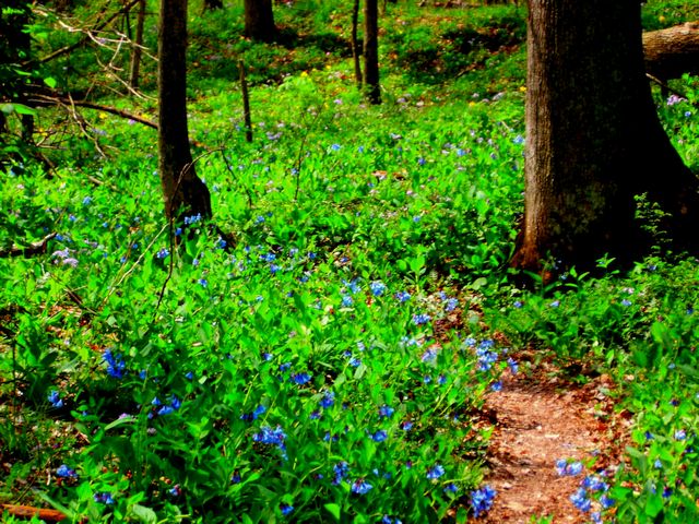
The trail begins with a pleasant stroll in the forest. It then follows the course of a spring fed stream. The best part of this hike is the extensive section which follows the course of the Vernon Fork of the Muscatatuck River. Some of the hike is along high bluffs overlooking the river, but there are spots which allow access to sand bars extending out into the river. In early to mid April this portion of the trail is emblazoned with thousands of Virginia bluebells in full bloom. These flowers line the river bank, the trail sometimes passing through vast beds of them. There are also some old hemlock stands along the river on these limestone bluffs. The trail finishes up by passing through some open fields before finally exiting at the parking lot on the opposite side of the road. The Violet and Louis Calli Nature Preserve Nature Trail is a fun and pretty place to visit for a hike.
Calli Nature Preserve
1200 North Private Road 40 East,
North Vernon, IN 47265
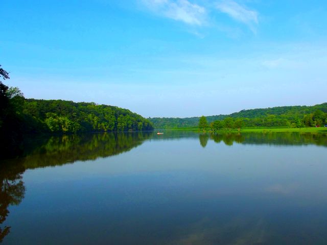
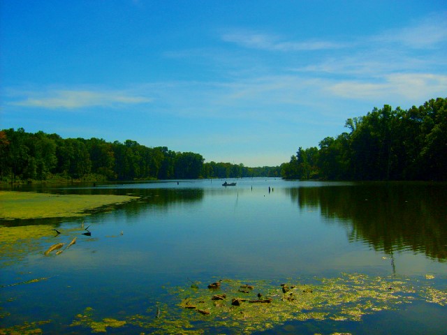
Versailles State Park
Versailles State Park, located east of Versailles Indiana on US Route 50 is Indiana’s second largest state park. It includes 5905 acres, the 230-acre Versailles Lake, a public swimming pool and one of the finest campgrounds in the Indiana State Park system. The northern area of the park features an extensive Mountain Bike trail system. Horse trails occupy the southern reaches. Wonderful hiking trails, fishing and boating are in between. Events at the park include the Bluegrass Festival the first weekend in October, a magnificent 4th of July fireworks show and a Halloween even in late October.
During the Great Depression the National Park Service determined that it would build a Federal park at a site near Versailles, Indiana in August 1934. By fall the Park Service had acquired 1700 acres for what would be the first Federal Park in Indiana. They chose the area because it was a marginal farm area. Called the Versailles Recreation Demonstration Area, the first of 200 Civilian Conservation Corps (CCC) workers arrived at Camp Laughery in January 14, 1935. The workers first constructed barracks, a mess hall and an administration building. These workers, who ranged in age from eighteen to twenty-eight years old, developed many of the features still visible in the park. By 1943 the Park Service had expanded the project to 5600 acres.
In 1943 the National Park Service transferred ownership of the park to the Indiana Department of Natural Resources. The Versailles Recreation Demonstration Area became Versailles State Park. Workers constructed Versailles Lake in 1954. The DNR has added new buildings and facilities to the park over the years.
Civilian Conservation Corps (CCC)
Established by executive order on April 5, 1933 by President Franklin D. Roosevelt, the CCC served as one of the most important parts of Roosevelt’s New Deal program to deal with the high unemployment during the Great Depression. The United States Army helped provide transportation for the men that would work on environmental conservation projects around the United States. By July 1, 1933 the CCC had established 1433 camps around the country, providing jobs for 300,000 men. By 1935 the CCC would have 2600 camps with almost three million workers. The CCC built 97,000 miles of roadway, planted 2.3 billion trees, developed 800 state parks and over 13,000 miles of hiking trails in those parks. Additionally, the men of the CCC stocked lakes and rivers with over one million fish and constructed 3470 fire towers. To enlist in the CCC the men had to be United States citizens, in good physical shape, single and between the ages of 17 and 23. The CCC later raised this age to 26. The monthly pay was $30.00 per month. They had to send $25.00 per month home to their families. The CCC added an educational program, which enabled over 40,000 illiterate men to learn to read and write.
Hikers will find almost seven miles of hiking trails plus many miles of mountain bike trails in the park. During the summer months a swimming pool is open which features a waterslide. The campground has 226 electric sites and a camp store.
Picnic Areas are scattered throughout the park and are available on a first come, first serve basis. The picnic areas include tables, grills, toilet facilities, playground equipment and playfields. Wood is available from camp store during summer months.
Anglers with an Indiana State Fishing liscense may cast their lines in Versailles Lake.
Picnic Areas and Shelters
Mountain bike trails total almost seventeen miles and include several skill levels from beginner to advanced.
6 Shadow Run Loop – 4.0 – Easy/Beginner
A naturalist is available three days a week from Memorial Day to the middle of August at the Nature Center. A seasonal interpretive naturalist offers hikes, educational and interpretive programs and evening activities.
xhibits on park’s natural and cultural history are on display at the Nature Center.
Visitors to the park can rent Canoes, Rowboats, and Kayaks.
A boat launch ramp allows boaters with small boats with electric trolling motors access to Versailles Lake. Boat Launch Ramp
Boat Motor / Electric trolling only
Equestrians have several miles of Bridle Trails to ride their steeds.
Versailles State Park
Mapping Address:
1004 U.S. 50
Versailles, IN 47042
http://www.in.gov/dnr/parklake/2963.htm
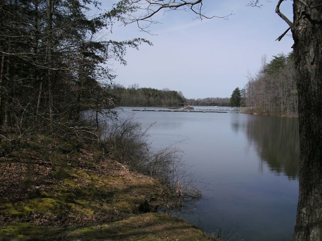
Hardy Lake and Campgrounds
Hardy Lake is a 741 acre located in the northeastern portion of Scott County and northwestern Jefferson County. Hardy Lake is accessed from Indiana State Road 256. Hardy Lake Road intersects State Road 256 about four miles east of Austin, Indiana. Construction on the lake, which was originally called Quick Creek Reservoir after the creek that was dammed to create it, was completed in 1970.
The full gamut of outdoor activities can found at this Hardy. There is boating, fishing, hunting, hiking and waterskiing available. You may swim on the large beach or play sports at the volleyball or basketball courts. Any other sport can be played on the open playfields. There is an archery range and a trail devoted to sharpening the archery skills of the hunter.
There are several hiking trails, including an archery trail that may be used to sharpen your archery skills. The trails are all located near the Alpha and Sunnyside Boat Ramps, except the Archery Trail that is located
The lake provides habitat for many species of birds. These include red-necked Grebe, Mute Swan, Snow Goose, and Black Vulture. Red-shouldered Hawks as well as many others have been sighted here.
Hardy Lake and Campgrounds
4171 E. Harrod Road
Scottsburg, IN 47170
(812) 794-3800
Mapping address:
5620 North Hardy Lake Road
Scottsburg, IN 47170-8438
https://www.in.gov/dnr/state-parks/parks-lakes/hardy-lake/
Find out more about these Indiana day trip destinations and many more by purchasing the book Southeast Indiana Day Trips. The book includes contact information for all of these museums as well as information on include, state parks, nature preserves, golf courses , wineries, breweries and much, much more. You can find it on my web site, http://www.mossyfeetbooks.com on the Road Trip Indiana category. Just scroll down to categories, click the Road Trip Indiana Series. There are links to Amazon, Barnes and Noble, Google Play and other online book sellers. You may choose to purchase the book in ebook or softbound versions. An audio book version is available on Google Play. There will be five more podcasts in this series covering some of the historical markers, court houses and underground railroad sites in the southeastern part of Indiana. At the conclusion of this series I will compile the episodes into an audio book. The next series will cover Indiana’s role in the Civil War. Listeners may also be interested in my book, The Ultimate Indiana Day Trip Travel Guide. The 747 page book includes a plethora of day trip destination in Indiana. A complete tourism guide the book includes local and state parks, museums, golf courses and much, much more. The book includes information on all of Indiana’s 92 counties. No traveler in Indiana should be without it.
You can also order these books direct from me, the author, on the web page. If you wish me to sign the book, just send me an email to mossyfeetbooks@gmail.com requesting a signed book and instructions on how you want me to address it. Note, if you send me an email, I will add you to my contact list. Readers on the list will receive an email from me announcing when I publish a new book. If you do not want me to add you to the list, tell me and I will not add you. Listeners to this podcast that want email notification of my new releases can just send me an email requesting addition to the list. You can choose to have your name removed at any time. If you browse the web site you will find dozens of sample chapters, one for each of my books. I hope you enjoyed this podcast and thank you for listening.
Indiana Places and History Podcast
Top of Page
Mossy Feet Books on Social Media
Twitter
Linkedin
YouTube
Pinterest
Online Sources for Mossy Feet Books
Paul Wonning’s Books on Amazon Page
Paul Wonning’s Books on Scribd Page
Paul Wonning’s Books on Apple
Paul Wonning’s Books on Kobo
Paul Wonning’s Books on Barnes and Noble
Paul Wonning’s Books on 24 Symbols
Paul Wonning’s Books on Google Play
Paul Wonning’s Books on Indigo
Paul Wonning’s Books on Playster
Paul Wonning’s Books on OverDrive
Search Paul Wonning on Ingrams
Table of Contents
© 2022 Paul Wonning
